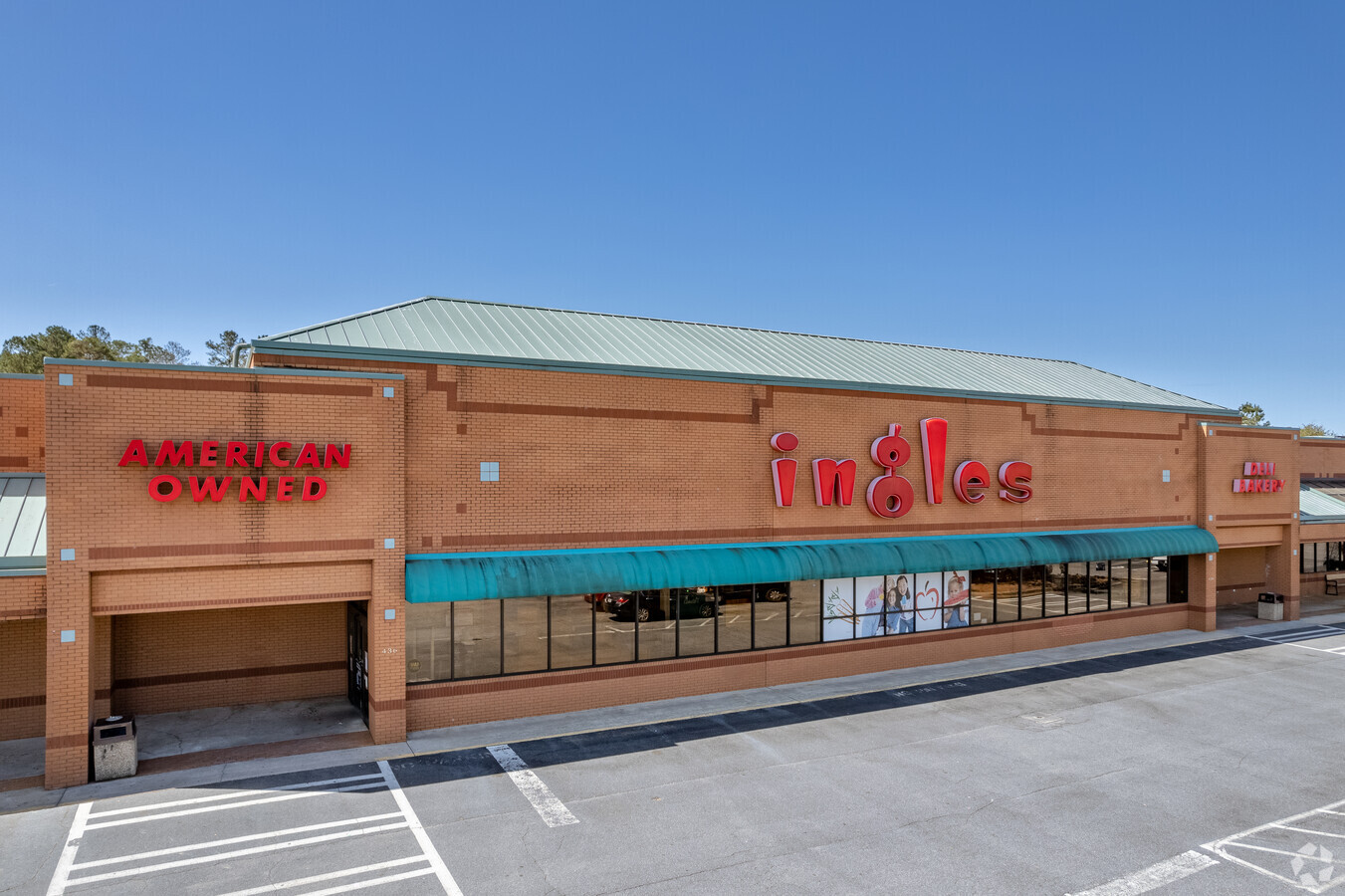
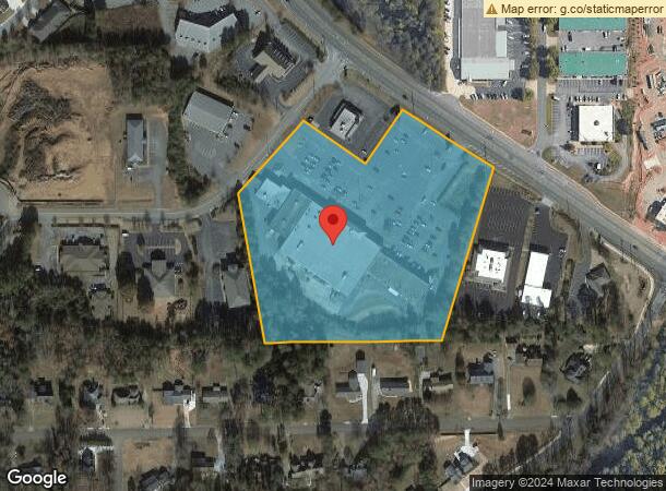
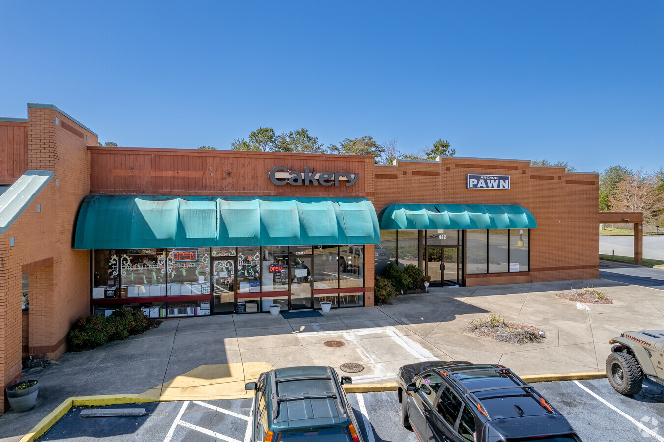
Property Record
432 Canton Rd, Cumming, GA 30040

NEARBY LISTINGS FOR SALE OR LEASE
Property Detail
432 Canton Rd
Atlanta-Sandy Springs-Roswell, GA
Canton Hwy Bus Dis
C06-014
3-1 1177 N CUMMING CORNER
Regionalshoppingcenterormallwithanchorstore
Forsyth
X
Georgia
13117C0134F
1177
2023
8.91 AC
2024
Cumming/Forsyth Cnty
130413
Atlanta
72,143 SF
DEMOGRAPHICS near 432 Canton Rd
1 Mile
3 Mile
5 Mile
2024 Total Population
4,684
38,293
108,747
2029 Population
5,460
44,603
126,863
Pop Growth 2024-2029
+ 16.57%
+ 16.48%
+ 16.66%
Average Age
42
40
39
2024 Total Households
1,687
13,498
36,995
HH Growth 2024-2029
+ 16.60%
+ 16.57%
+ 16.74%
Median Household Inc
$77,929
$97,793
$113,136
Avg Household Size
2.70
2.80
2.90
2024 Avg HH Vehicles
2.00
2.00
2.00
Median Home Value
$330,784
$376,302
$421,074
Median Year Built
1995
2002
2003
Nearby Places
- Restaurants
- Banks
- Shops
- Fitness
- Groceries
SALE & LEASE HISTORY
LISTING DATE
SALE/LEASE

Sep 24, 2016
For Lease
Nearby Properties
Address
Land Use
TOTAL SIZE
Lot Size
Zoning
Address
Land Use
TOTAL SIZE
Lot Size
Zoning
8,848 SF
15.75 AC
PUD
Address
Land Use
TOTAL SIZE
Lot Size
Zoning
581,433 SF
31.45 AC
INST
Address
Land Use
TOTAL SIZE
Lot Size
Zoning
10.82 AC
PUD
Address
Land Use
TOTAL SIZE
Lot Size
Zoning
15,081 SF
27.53 AC
R3
Address
Land Use
TOTAL SIZE
Lot Size
Zoning
312,095 SF
28.86 AC
PSC
Address
Land Use
TOTAL SIZE
Lot Size
Zoning
208,496 SF
23.61 AC
R3
Address
Land Use
TOTAL SIZE
Lot Size
Zoning
302,599 SF
35.89 AC
R3
Address
Land Use
TOTAL SIZE
Lot Size
Zoning
173,374 SF
32.90 AC
CBD
Address
Land Use
TOTAL SIZE
Lot Size
Zoning
15,600 SF
21.98 AC
R3
Address
Land Use
TOTAL SIZE
Lot Size
Zoning
222,893 SF
103.13 AC
M1
Address
Land Use
TOTAL SIZE
Lot Size
Zoning
95,926 SF
34.26 AC
HB
Address
Land Use
TOTAL SIZE
Lot Size
Zoning
149,540 SF
43.76 AC
INST
Address
Land Use
TOTAL SIZE
Lot Size
Zoning
62,085 SF
28.70 AC
INST
Address
Land Use
TOTAL SIZE
Lot Size
Zoning
120,750 SF
9.37 AC
INST
Address
Land Use
TOTAL SIZE
Lot Size
Zoning
24.78 AC
INST
Address
Land Use
TOTAL SIZE
Lot Size
Zoning
11,737 SF
34.75 AC
A1
Address
Land Use
TOTAL SIZE
Lot Size
Zoning
42.50 AC
RES3
Address
Land Use
TOTAL SIZE
Lot Size
Zoning
99,232 SF
Address
Land Use
TOTAL SIZE
Lot Size
Zoning
109,856 SF
12.94 AC
CBD
Address
Land Use
TOTAL SIZE
Lot Size
Zoning
85,398 SF
Address
Land Use
TOTAL SIZE
Lot Size
Zoning
152,562 SF
12.80 AC
R3
Address
Land Use
TOTAL SIZE
Lot Size
Zoning
159,291 SF
29.19 AC
MU
Address
Land Use
TOTAL SIZE
Lot Size
Zoning
268,761 SF
55.50 AC
INST
Address
Land Use
TOTAL SIZE
Lot Size
Zoning
65,364 SF
15.29 AC
PSC
Address
Land Use
TOTAL SIZE
Lot Size
Zoning
127,940 SF
14.30 AC
HB
Address
Land Use
TOTAL SIZE
Lot Size
Zoning
89,312 SF
7.50 AC
M1
Address
Land Use
TOTAL SIZE
Lot Size
Zoning
267,180 SF
31.01 AC
INST
Address
Land Use
TOTAL SIZE
Lot Size
Zoning
89,562 SF
10.61 AC
CBD
Address
Land Use
TOTAL SIZE
Lot Size
Zoning
68,498 SF
Address
Land Use
TOTAL SIZE
Lot Size
Zoning
175,237 SF
2.13 AC
CBD
The World's #1 Commercial Real Estate Marketplace
Connect with us
© 2025 CoStar Group
The information above has been obtained from sources believed reliable. While we do not doubt its accuracy we have not verified it and make no guarantee, warranty or representation about it. It is your responsibility to independently confirm its accuracy and completeness. Any projections, opinions, assumptions, or estimates used are for example only and do not represent the current or future performance of the property. The value of this transaction to you depends on tax and other factors which should be evaluated by your tax, financial, and legal advisors. You and your advisors should conduct a careful, independent investigation of the property to determine to your satisfaction the suitability of the property for your needs.